WOSSA - Bikepacking Route

BikepackingTrip

Distanza

567km

Giorni

7

Non asfaltato

38%

Singletrack

2%

Difficoltà

8/10

Pedalabile

100%

Salita totale

8176m

Superficie

Gravel

12 12 2024

Explore water circulation in the Alps by bike

Descrizione del percorso
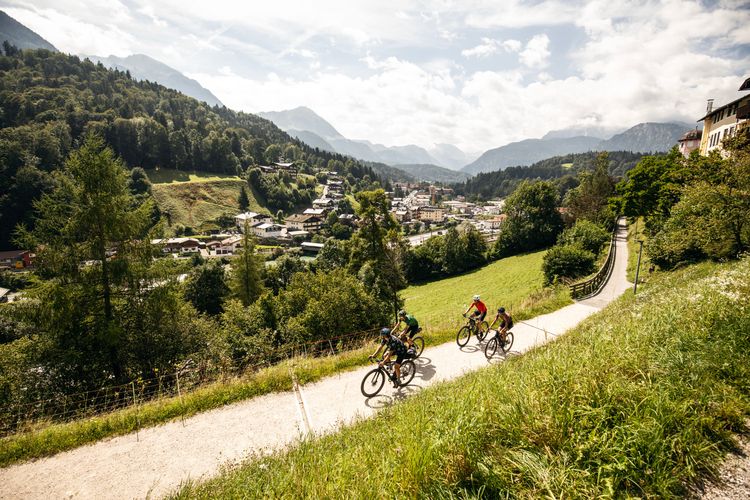
Water is... everywhere?

Cells consist of 70-80% water. In fact, the majority of scientists agree that life on earth began with water.
And if we look at our planet on a satellite map, we can see huge areas of water. 71% of the earth's surface is covered with water.
However, only 3% of this is fresh water. And only 0.3% of it is found in rivers, lakes and the atmosphere.

Cycling and water

Especially in the Alps, water is all around us. Every valley we cycle along a river, around a lake, we look at snow-covered mountains and yes, on some tours we go high up and may even see a glacier!
So you could say that the water also strongly influences the planning and shape of our cycle tours.

And yet we usually only stop for a photo if we do. The fascinating world that lies within the ecosystem that we experience so closely, thanks to our bikes, is so far away from us. Too complex for us to see through and explore at this very moment.

Discovering water in the alps hands on during the wossa bikepacking adventure route.

WOSSA is here to change that! A bikepacking adventure specifically designed for gravel bikes takes you to picturesque Berchtesgaden, through the Chiemgau Alps, through the Chiemgau Lake District, to Salzburg's Flachgau and Tennengau regions and all the way down to the Salzkammergut and its large lakes.
You will explore the northernmost glacier in the Alps and one of the largest remaining glaciers in the Eastern Alps. From small streams to the great river whose power supplies hundreds of towns with electricity.


WOSSA explains how the water gets to (and stays) in the high mountains and then makes its way to the Alpine foothills and on to the sea.
As you can see, the whole thing is a cycle.

‘You can't lose anything, only gain knowledge’

How do you present such a complex topic without turning it into a school assignment? WOSSA takes you out and makes the topic tangible. Along the route, you will explore various important points that will introduce you to the functions of the water cycle in the Alps.

What functions are there in the high mountains?

  • High Mountains are distributors and guides of precipitation through their influence on moving air masses. (Large-scale weather situations up to ‘it's raining here in the valley, everything is dry in the neighbouring valley’)
  • Delaying the formation of runoff, which turns precipitation into runoff more or less quickly depending on the slope, type of rock, vegetation cover and soil.
  • Suppliers and repositories of sediment, wood and other organic matter, which are essential for the shape and organisation of rivers.

Jost Litzen of Basic Bikes. Our sustainability Expert!

This is the very short version by hydrologist Ingo Schnauder from the Technical University of Stuttgart.
By the way, he also wrote the title of this section.
In total we worked with 3 Scientists to validate the info provided on the route. Ingo Schnauder from the TU Stuttgart, Nils Rüther from the TU Munich and Markus Keuschnig CEO of Augmenterra and Georesearch.
On top we have a sustainability consultant and climate expert with Jost Litzen from Basic Bikes and wecologic.


Broken down into 3 categories, we can explain these functions using examples along the route.

The Frillensee lake in Bavaria is the coldest lake in germany and you can cycle there with a gravelbike.

Reservoir

The precipitation in the mountains moves downwards due to gravity. However, in certain places and through various processes, this runoff is delayed.
Depending on the gradient, type of rock, vegetation cover and soil, the water is transported into the valley more or less quickly.
It is stored, for example, by snowfall, where, especially at higher altitudes and seasonally, the water remains as snow and is later released by melting.
In high alpine locations, glaciers are also formed in which the snow turns into a sheet of ice and slowly ‘slides’ towards the valley.
There are also lakes. These can also form in different ways.
Finally, on this route we look at peatlands as an important reservoir and ecosystem.

The Saalach river is one of the largest on the WOSSA Bikepacking route.

Transport

Rivers transport water, sediment and organic material (e.g. dead wood).

The potential energy of the water that rains down in the mountains is released via rivers. The mobilisation and transport of sediments are important ‘regulatory functions’: if more water and more energy is available, sediment is released and carried along; if there is too little energy, it is deposited.

These transport functions and the energy balance also determine the shape of rivers, i.e. how they flow, meandering or branching, and whether there are gravel banks or steep banks.

Mineral water springs are one way of how humanity uses water. You can learn about it cycling the WOSSA bikepacking route.

Usage and conflict

We make use of the water. Traditionally, this might have been fishing or a mill.
Over 26% of the electricity generated in Austria is now produced from hydropower. In fact, we can count the number of unmodified rivers on one hand.
However, dams and hydropower plants are just one of the many ways in which people utilise water.
The use of water is a major achievement of our civilisation.

As soon as we intervene in an ecosystem, however, certain conflicts always follow.
Where there's a conflict, there's a solution?
We would like to show you a few examples of this and also offer possible solutions and expert opinions.

With a brevet card into your ‘wet’ adventure

Brevets are probably one of the oldest formats in cycling. It's not about winning, it's about overcoming a challenge, a close-knit community that overcomes a challenge together on a bike.
Successful completion of the challenge is confirmed with a stamp on the brevet card.
We intend to use this old tradition here too. You can pick up your Brevet card at the tourist information centres in the participating regions and then complete small challenges at certain locations along the route that will test your knowledge of a water-related topic.

Don't worry. It's not a school test, just a little extra story about your bikepacking adventure. And if you're intrigued by the topic, you can get more info via QR code on a separate page with scientific input on gravgrav.cc!

You can obtain the Brevet cards free of charge from May 2025 from the following tourist information centres:

After your trip, the brevet card will remind you of your trip and hopefully find a place to admire it at home!

bikepacking through Berchtesgaden. An alpine gravelbike adventure!

The Route

The route can be tackled from May to October, depending on the snow at higher altitudes. Of course, it can also be too cold and unstable earlier, or the route can be travelled earlier or even later.
We have made sure that you can get on at various points, which is why you can see all the major railway stations marked in the POIs on the map.

With just over 560 kilometres and just over 8000 metres of altitude in total, we recommend that you take between 5 and 7 days. If you want to cycle faster or slower, you can! We marked the larger towns and accommodation options on the map.

As a ‘figure of eight’, you can also ride either just the northern half or the southern half, and even the Berchtesgaden loop in isolation would be possible as a day tour!
As you can see, the entry should be as easy as possible and the route as inclusive as it can get. The terrain is designed for gravel bikes and while you might get a little shaken up sometimes or have to master a steep climb, everything is rideable and should offer you fun and a great experience.
If something changes, for example a path is not passable, there is damage to a path or a new ‘no cycling’ sign has appeared, please let us know!
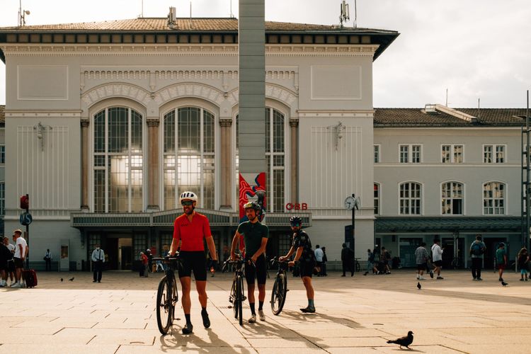
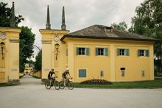
The train station in Salzburg is the perfect starting point for our bikepacking adventure!

Start in Salzburg

The city of Salzburg is world-famous. ...for Mozart and chocolate balls, of course.
And the imposing old town, crowned by the fortress, crowned by the incredible Alpine panorama. For sports enthusiasts, Salzburg is particularly characterised by diversity:
High mountains to the south, hilly terrain to the north, many lakes and sport is possible in every conceivable way in winter and summer!
Salzburg is also very close to Munich and Vienna, and you can also get to Italy in under 4 hours.
Salzburg is therefore an ideal starting point for our bikepacking adventure! And Salzburg Central Station is our gateway to the Alps and the water.
It goes without saying that you'll find plenty of accommodation and restaurants here. From classic, traditional cuisine to Thai snacks and award-winning restaurants, you'll find everything here!
Cyclist-friendly cafés such as Ma Makers, Kaffee Alchemie and Ratio Coffee will also give you a caffeine and sugar boost before you set off on your bike!
It's only a short distance from the main railway station to the Salzach. We'll spend more time on the Salzach, one of the largest rivers on our route, later on!
For now, you can enjoy the cycle path along the river. We turn off at the railway bridge and follow the cycle path along the railway line. This will take us to the Saalach and the German border with almost no traffic.

crossing the border between austria and germany while bikepacking. beautiful and easy along the saalach river.

With panoramic views into the heart of the Berchtesgaden Alps

We follow the Saalach along a wide, perfect gravel cycle path. We can already observe something interesting along the Saalach.
The riverbank is being ‘renaturalised’. You can find out more about this on the information board along the path. A little mental exercise: What does ‘renaturalised’ actually mean? Which point do we refer to as natural and what is the goal?
More on these topics later 😉
At the Hammerauer Steg in Wals, we now cross the Saalach and cross the border into Germany. We cross a few more borders on this tour and, as you can already see, there are no border controls here, and the massive wooden bridge is beautiful too!
On the German side, we cycle a little further along and under the motorway, then we cross the Saalach again on gravel and a large pedestrian bridge. To the south-west (or simply look to the right) we see imposing mountain panoramas and the Saalach cutting deep through them.
The gravel path now takes us through the Saalach Erlebniswelt and the Marzoller Au. There is a lot of water here in small ponds and moors. An important biotope that provides a habitat for many species and stores a lot of CO2.
You can find out more about this on the information boards along the way.

Bikepacking in a nutshell. A lot of coffee and pastries. Of course there's a lot of that on the WOSSA bikepacking route.

Now it's uphill for us! Via Großgmain and Hallthurm, we cycle along the tarmac and cycle path between the Untersberg and Lattengebirge mountains.
Two large mountain massifs that characterise the landscape and therefore also the climate and water supply of the landscape we are cycling through!
Can you see the water flowing down from the mountains?
We now cycle via Bischofswiesen along the road to Berchtesgaden. A gentle start, enjoy the panorama!
Berchtesgaden is certainly one of the most famous mountaineering destinations you can imagine. The picturesque panoramas, the historic old town and many bakeries, restaurants and accommodation invite us to linger!

The Königssee Ache is an impressive mountain river in Bavaria on our bikepacking adventure WOSSA.

The Königssee lake - an electrifying experience

And from Berchtesgaden, we travel straight on to the next famous mountaineering resort. Ramsau in Berchtesgaden lies at the foot of the famous Watzmann and the Hochkalter. The 2 highest mountains in the region.
But we would like to show you a few real highlights on the way there. Firstly, we don't just cycle along the main road, we show you the Königsseer Ache, also known as the Berchtesgadener Ache.
It flows directly to the Salzach, where it joins the river. Just so we've mentioned the topic of circulation again 😉
We cycle along the Ache on gravel. We can hear the rushing of the river. The steep mountains that surround us only give us an idea of the force with which the water flows down the mountains by gravity and now literally shoots through the valley. The path along the Ache leads us directly to the Königssee.
It lies picturesquely amidst steep rock faces. The historic boathouses are a reminder of the traditional use of boats on the Königssee. Until 1908, this was still done using muscle power and rowing. Since 1909, who would have guessed, electrically!
The passionate hunter Prince Regent Luitpold ordered electric operation as he did not want the game to be driven away by noise.
Incidentally, the bobsleigh run is right next to our viewpoint on the lake. As well as being used by tourists, the operation of the ice arena is a fascinating use of water at Königssee!

A swim in the Königssee lake is fantastic but cold. Bikepacking summer breaks!

Off to the northernmost glacier in the Alps.

Now we lead you uphill on gravel, away from the lake and, as promised, towards Ramsau.
The small path along which we lead you soon becomes a side road winding through forest and mountains.
Watch out, here comes a steep descent on gravel! If you want to be on the safe side, you should push here - there's no shame in that.
We are now at the bottom along the Berchtesgadener Straße and can follow the cycle path alongside it.
This brings us to the small village of Ramsau. We find everything we desire. Bakery, small supermarket, accommodation, restaurants,... It's simply picturesque here!
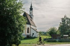
The church directly above the Ramsauer Ache river with an impressive mountain panorama behind it is well worth a photo!
We follow the road for a while before turning right onto a gravel road. It goes downhill for a short distance before we head steeply uphill.
The so-called enchanted forest “Zauberwald” lives up to its name! A deep forest, quiet and with a magical atmosphere. The steep ascent demands everything from us, but we are rewarded by the picturesque, deep forest and then by the view of Hintersee!
We are not fans of in and out routes. That's why it's not officially on the track, but we recommend that once you're on the road, you follow it to the boat docks.
This is where you will find the answer to the first challenge on your brevet card!

gravelbiking with a view on the Blaueis glacier in Berchtesgaden!

The short, steep ascent on tarmac also gives you a fantastic view of the lake and, more importantly, the Blaueis Glacier!
It's the northernmost glacier in the Alps and as you can (hopefully) see, it's only tiny. In the brevet card you will find a QR code to our detailed article about the water POIs along the route and the scientific input if you want to learn more about the topic.

Via the Schwarzbachwacht stream back to the Saalach river

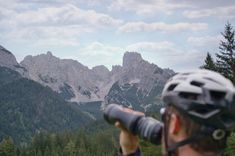
Now we cycle uphill along a wonderful gravel path and can marvel at the incredibly beautiful panorama of the Berchtesgaden Alps.
The path winds through the forest and becomes light again, then we cross the road and cycle along the Taubensee lake. It's worth taking a look at the small lake!
We soon reach the highest point and a rapid descent awaits us. We ride steeply downhill on a gravel road through a beautiful alpine landscape.
Beware, the steep descent also has bends, so you should adjust your speed here.
Small huts with an epic mountain panorama in the background fly towards us and we come to a river crossing, the Schwarzbachwacht. A small wooden footbridge leads across, the water rushes underneath.

Schwarzbachwacht is an impressive alpine experience for bikepackers and gravelbikers!

Normally at least! When we were there, the ford was dry, but we hope that you will have the full experience with plenty of water.
We now continue along the Schwarzbach towards the valley until we reach the Deutsche Alpenstrasse road for a short distance. But don't miss the turn-off, we soon turn right onto a small trail that leads us onto a small road that is closed to traffic.
We follow this down to the main road. This is where the subway and cycle path guessing game really becomes a labyrinth. Just follow the signs towards Schneizlreuth and Bad Reichenhall! But soon we find ourselves at the Saalach and cross it to cycle towards the valley on the left-hand side.

In Bad Reichenhall we can see a lot of human buildings regulating flow and shape of the Saalach river by bike!

The Saalach hydropower plant

As you cross the Saalach, you will find an information board that gives you some information about the Saalach.
On the Kiblinger Weg, we glide along on a tarmac path and the Saalach becomes a lake!
It gets wider and wider and a wide expanse of water spreads out in front of us. A dam awaits us at the end.
The Saalach power station was built in 1914 to run the railway network with the help of hydropower. And it still does so today for Deutsche Bahn!
It's time to take a look at your brevet card. Hydropower is one of the largest energy suppliers in the Alpine region and works without using fossil fuels. You can learn more about the benefits, opportunities and conflicts here!
Now we take a relaxed ride downhill to the spa town of Bad Reichenhall. The spa town is also a good place to end our first stage!

The Gradierhaus in Bad Reichenhall is a remarkable place to visit on a bikepacking trip through Bavaria.

From Bad Reichenhall through the Chiemgau Alps

We also have one or two little water wonders for you in Bad Reichenhall.
Firstly, the Old “Saline" shows you how the famous Reichenhall salt was produced from brine in Bad Reichenhall from 1844 to 1929. The most impressive thing here is probably how beautiful an industrial building used to look!
We would also like to recommend a walk around the Gradierhaus. However, you'll have to go without a bike as the Gradierhaus is located in a spa park where bicycles (even pushing bikes) are not allowed.
The building is impressive and if you are too curious to find out about its purpose and history on site, you can find all the insider information here.
We add it as a POI on the map, but if you don't have a lock or the option to leave your bikes behind, you don't HAVE to go there 😉

The Frillensee is a small and very special lake along the WOSSA bikepacking route in Bavaria.

To the coldest lake in Germany 🥶

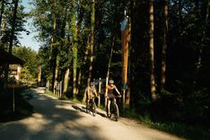
We cycle along the Saalach river out of Bad Reichenhall and enjoy great cycle paths and a beautiful gravel road through the Nonner Au.
In case you're wondering:
The high mountain next to you is the Hochstaufen and we cycle quite a way around it!
On small roads, paths and even short single trails, we take you to... Anger. No joke, but you certainly won't find any particularly angry contemporaries here.
But you will find a few inns, cafés and a great bakery!

You should treat yourself to some refreshments, because now it's time to get up high!
We ride upwards along the Stoisser Ache on a wide and fine gravel road. The stream rushes down the steps beside us and it is mostly shady and cool here.
However, it soon becomes steeper, which of course makes it hotter for us. 😉
However, we only follow the ascent to Stoisser Alm for a short distance (we'd recommend this for another time!) and turn left at the second hairpin bend. Here we continue uphill for a while before we can enjoy a short descent and come down to Adlgaß.
We make a 180-degree turn here and head straight back uphill to Frillensee. The ascent is now only quite steep at the beginning before we glide gently towards Frillensee. There you will also find a fountain where you can top up your water with fresh spring water!
Here we are at the small but beautiful Frillensee lake! The Hochstauffen rises imposingly and rockily behind it, we are surrounded by high rock faces and forest. Even in summer, it is much cooler here than in the surrounding areas.
You should get out your brevet card again here. What makes the lake so special? Can you learn anything from it for everyday life?

St. Georgsquelle is a small alpine spring we are showing you along the WOSSA bikepacking route.

The springs of Bavaria

From Frillensee we now ride downhill on a forest road back to Adlgaß. There is also a short trail included. It will shake you a bit here, but it's fun and also easy to ride on a gravel bike. At the end, a fantastic view of the Chiemgau Alps awaits you.
We wind our way around Inzell and ride along small farm tracks through a hilly landscape. We alternate between gravel roads, forest tracks and small tarmac roads and arrive back at the winter sports resort of Ruhpolding.
First we ride around the village to the south, where we have included a small gravel ramp for you. Mean, but much nicer than the main road!
We'll take you to a special place here. If you're wondering why you have to take a small detour off the road and back out again, this is the way to St George's Spring!
It used to be called the Zell spring, but is now named after St George. Will you be able to conquer dragons thanks to its water?

What you can definitely do is brag about knowing what an artesian spring is!
Artesian water often accumulates over centuries between impermeable layers and then finds its way upwards due to overpressure.
In this case through a well, which transports the water upwards via a pipe. The water here is bottled and sold. However, you can also taste it at the spring and, if you wish, donate something to help preserve the spring.
The next stop is in Siegsdorf, while Bergen and Staudach also offer plenty of accommodation. If you want to stop earlier, you will of course also find plenty of accommodation in Ruhpolding!

Continue through the Chiemgau Alps to Rosenheim

Cow content is key! Bavarian cliches when gravel bikepacking.

The next spring in Bavaria

The Adelholzen Alpine spring is known far beyond the borders of Bavaria. We ride right past the Primus spring!
By now you know what an artesian spring is. The water here also comes from great depths far below the groundwater level and the spring is considered the largest mineral spring in Bavaria.
You can almost always see a queue of people at the spring, which is just a few metres above the road, filling up the water and taking it home with them.
The water is also said to have healing properties.
But how much water can we take? Where does it come from and could our use of deep water lead to problems?
Time to unpack the brevet card for a little more information on Bavaria's springs and the groundwater problem.

From deep springs to wet peat bogs

We meander around Bergen a little and enjoy the best gravel. To the west of Bergen, we pass the Bergen Moss. An information board at the crossing of the Weiße Achen will tell you more.
To comply with the protection periods for meadow breeders in summer, we have to take you along a cycle path next to the main road. The cycle path is well maintained and fantastic to cycle on, but you will have to look at the Bergener Moos from a distance!
You will soon reach Staudach. Here you'll find bakeries, cafés, accommodation and more, we'll send you through quickly and you'll be at the Kendlmühlfilzen.
Here, too, you will find information boards explaining the special features of this nature reserve. Hmm,_ moss, felt... both are moors, but what's the difference?_
In your brevet card you will find a challenge that will lead you to the explanation and give you more interesting information about moors and their function in the ecosystem. You can tackle this challenge at any moor along the route.

panorama tower along the Simssee in chiemgau, bavaria. Alpine Gravel adventure.

Via Bernau am Chiemsee to Lake Simssee

We will now take you quite close to Lake Chiemsee, but not directly to it. Bernau of course offers you everything from cafés and inns to accommodation.
We now take you first southwards, then northwards. We take you through a maze of gravel roads and smaller farm tracks and through the Achthal. This part of the route is definitely exactly how we want a gravel route to be! And you'll also cross many streams and creeks here!

We now come out at Lake Simssee. Along the northern shore we see an observation tower that you should climb up to. Here you can see a moor in front of the lake, then the long, large lake and the impressive panorama of the Alps in the background! Do you understand where the water in the lake comes from?

The Mangfall river in Rosenheim has a nice gravel bikepath next to it.

From Simssee lake on gravel to Rosenheim

A nice little road leads along the Simssee lake and at one point a wide gravel road. We continue along the railway line to Rosenheim. One of the largest towns along our route.
Rosenheim is also a good place for a stop. Here you will find plenty of accommodation, restaurants and more. Thanks to the large railway station, it is also a good place to start the route from.

From Rosenheim to Waging am See

Flood protection along the Inn

When we cycle out of Rosenheim, we cycle directly along the top of the dam next to the Inn river. Don't cycle below on the road, it will be difficult to get back up!
At the top we can see over to the Inn. In between is a fairly large green area and even a strip of forest. What is this good for?
You'll find a challenge here on your brevet card. Use the QR code to find information about the function of this grassland.

The Inn is one of the largest rivers on the route WOSSA route and this is one of the interesting features you will learn about.

We now pass many small lakes. And we also cycle through the Stucksdorfer Moos. Still wondering what a moss is and what a felt is? The brevet card will enlighten you!

From Bad Enndorf to the Seeon Monastery

The next major town on our route is Bad Enndorf, where you will find supermarkets, restaurants, cafés and accommodation.
From Bad Ennsdorf we now cycle to the Eggstätt-Hemhofer Seenplatte. This is a special nature reserve consisting of 17 individual lakes. It is a landscape of glacial decay that was left behind after the glaciers retreated during the last ice age.
In the next section, we get very close to Lake Chiemsee, maybe you can even catch a glimpse of it? But we'll keep you away from the hustle and bustle and instead lead you through dense forests, over crackling gravel and through mystical moors.
This is how we get to the Seeon Monastery. Together with the Eggstätt-Hemhof lake district, the Seeon lake district forms a biotope network axis that promotes the exchange of endangered animal and plant species.

The Seeon monastry is definitely a highlight when bikepacking through Bavaria.

From Seeon Monastery to Lake Waginger See

The monasteries at Klostersee are a special highlight. They are a former Benedictine abbey and are now a cultural and educational centre.
You should definitely take a few photos here!
We cycle along the Alz and Traun rivers on gravel and small roads until we reach Lake Waginger See. We would like to recommend this as a stage destination.
Not only is it beautiful, you'll also find hotels and much more here!

Waginger See is beautiful to cycle along. Bikepacking in Bavaria.

Via Oberndorf/Laufen into Salzburger Land

It's not far from Waginger See via Kirchanschöring to the Salzach. Do you remember? The Salzach is the river that flows through Salzburg. So we were there at the start of our tour!
An excellent gravel path leads us along the Salzach to Laufen on the Bavarian side and Oberndorf on the Salzburg side. The river separates the two towns, which are practically one, but a magnificent bridge connects them!
There is also good ice cream, cafés, accommodation and more. A great opportunity to take a break!

Fountain near the bridge between Oberndorf and Laufen on the WOSSA Bikepacking gravel route.

The Salzburg Lake District

Salzburger Land is famous for its lakes surrounded by high mountains. But we have to work for the view of these!
First we ride out of Oberndorf up to Haunsberg. And this is where it gets really steep.
But the view of the lakes from the top is well worth the effort! The three lakes Obertrumer See, Mattsee and Grabensee are right next to each other. In Austria, people like to emphasise how clean the lakes are. ‘Drinking water quality’ is also often used in tourist communications. You can find more information on this topic in the brevet card!

The Salzburger Seenland lakes have breathtaking views and clear water with drinking water quality.

Back to Salzburg via the Teufelsgraben gorge

It's almost all downhill all the way back to Salzburg. However, along the way we ride through the Teufelsgraben!
We ride downhill into the ditch, to the small stream that rushes through. We see a mill on the edge. Again, here the water has been used for a long time.
Can you feel the difference in temperature?
Now we cycle along small farm tracks and side roads back to the Salzach. A wide cycle path along the Salzach leads us directly back to the city.
The Salzach is wide, it often seems calm, but it flows at a high speed. On the way into the city, we pass the Lehen power station. A modern, somewhat brutalist-looking dam right in front of the historic old town. Can you still remember the challenge and the explanations at the Inn in Rosenheim? The same themes also apply to the Salzach!
Salzburg is perfect for a stop. It is the largest city on our tour and, in addition to many cultural and culinary highlights, we can recommend exploring the Almkanal, for example.

From Salzburg to the Tennengebirge mountains by gravel bike

Along the Glan river to the Untersberg

Now we set off for the southern loop. So you've already explored half of it! We meander through the city and see the Almkanal hidden here and there in the urban environment.
Incidentally, this is the oldest water and energy supply system in Central Europe!
We also pass one of our favourite bike shops with Fanzy Bikes, should you need anything.
After passing the famous Stiegl brewery, we come to the Glan. It is one of the larger tributaries of the Salzach that come from the Untersberg. The massif of the Untersberg is huge and criss-crossed with a huge system of caves.
Passing through Fürstenbrunn and past Glanegg Castle, we circle the Untersberg a little and reach the valley station of the mountain railway.

Hallein invites us with amazing Cafés and accomodation. A good stop while bikepacking!

Hallein as the gateway to the Tennengebirge mountains

Here we meet the Königsseer Ache again and follow it for a while before returning to the Salzach on quiet side roads and following it to Hallein. Again we see dams and power stations.
In Hallein we can recommend a good café and ice cream! The town is large and also offers accommodation for you and a fairly large railway station.
Leaving Hallein, we take a road that gets narrower and narrower, deeper and deeper into the Salzach Valley. It winds along the foot of the Hohe Göll massif and every now and then we see the Salzach.
This quiet road takes us uphill and downhill to Golling. In the centre of the Salzach valley, at the foot of the Tennengebirge mountains and crowned by Golling Castle.
Gourmets also get their money's worth here, as the town is known for its award-winning restaurant. But you will of course also find more budget-friendly inns, cafés and accommodation here.

The Tennengebirge mountains are towering above us while we ride our gravelbikes along the lammer river in Salzburg, Austria.

Along the Tennengebirge to Abtenau

Now we cycle away from the Salzach and along the Lammer.
A cycle path leads us directly along the Lammer and the Tennengebirge mountains.
The steep rock faces drop down to the Lammer, which runs right next to the cycle path. We soon turn off and follow the smaller Klausgraben upwards. The mountain range builds up beside us and the chutes are striking. Steep rocks with chutes in between. Everywhere we go, we can be sure that water is running down the mountain and joining the larger rivers in the valley below.
But what makes the Tennengebirge so special? Check your Brevet card for a little geology exercise. 🤓
The climb is steep in places, but the view and the atmosphere make up for it. Once we reach the top, we see a completely different panorama. We now descend to Abtenau.

There are supermarkets, cafés, restaurants and plenty of accommodation here. Now it gets mountainous, so if you are already tired, you can rest here, the next opportunities are in Rußbach at Pass Gschütt and in Gosau.

Many hairpins in the road up to Pass Gschütt, before we can enjoy a breathtaking panorama of the Salzburg Alps!

From Abtenau over the Pass Gschütt to Gosau

The first climb out of Abtenau is short and offers us an incredible view! A long winding road takes us back down to the River Lammer.
Once at the bottom, we follow the road to the main road. We cross this briefly and come to the next, somewhat longer and sometimes steeper ascent. The sign at the start of the climb is sure to make you smile. Watch out for all those hairpin bends! Now it's time to count.
The road winds its way up through the forest and, if we're lucky, the sun will cast rays of light through the trees, creating a dreamlike atmosphere!
We soon leave the forest and can enjoy an incredibly beautiful panorama!

Now we cycle back downhill to the main road and arrive at Rußbach am Pass Gschütt. You can take a short break here, but you will also find accommodation in the small village.
If you still have some strength in your legs, continue on and reach the Pass Gschütt. Here you are on the border between Salzburger Land and Upper Austria. The wide road leads us down to Gosau at breakneck speed. You have to be careful not to fly past.

Lake Gosausee is not directly on route but if you have time go and look at the majestic Dachstein Glacier!

Gosau is surrounded by impressive mountains. We would love to take you up to Lake Gosau and show you the view of the Dachstein glaciers. If you feel fit enough for an extra climb and have the time, you can of course do so!
Even if we can hardly see them from our route:
The Dachstein glacier network is the easternmost glacier in the northern Limestone Alps and also the largest in terms of area.


Why is this the case and why is it shrinking at record speed?
Pull out your brevet cards for a little experiment that will illustrate this for you!

Hallstatt is known for it's incredible Panorama with the historic town buildings and mountains in the back. Can't miss it on our WOSSA Bikepacking adventure.

With the gravel bike through the Salzkammergut

From Gosau to Hallstatt and Lake Hallstatt

From Gosau, we first ride to the Gosaubach stream and enjoy beautiful gravel tracks across open fields and through dense forest.
Before we get back on the road, we pass between two fishing ponds. Artificially created lakes for the purpose of fishing. Can you see any fishermen?
The road hugs the valley and quickly leads us downhill.
This is how we arrive at the famous Lake Hallstatt! Just a little further along the road, then we mustn't miss turning left before the tunnel, which is closed to pedestrians and cyclists, so we can get straight into the village.
There's always a lot going on here! Thousands of tourists visit the town, which is famous for its panoramic views, every day. There is plenty to eat and drink here, and there is also accommodation. But of course you should book well in advance.

The Cycling path above the lake Hallstatt is fantastic!

Via the east bank cycle path to Bad Goisern

We follow the road out of the village, it leads through galleries and past beaches. There is always a steep rock face beside us.
We soon cross the large Koppentraun river and pass through the small village of Obertraun, where there is a kiosk right on the way.
Then we come to the beautiful east bank cycle path along Lake Hallstatt!
Partly on gravel and partly on tarmac, it leads us along the shore and suddenly we are cycling above the water!
The path runs along a rock face on a** metal footbridge over the water**. A crazy experience that you should have done once.
There are also a few small ramps and climbs, but nothing wild.
We soon arrive in Bad Goisern. The cycling capital of the Salzkammergut. Known far beyond the borders thanks to the Salzkammergut Trophy. A mountain bike marathon that attracts thousands of athletes to the mountains of the Salzkammergut every year.
You'll find everything here from modern traditional cuisine, bakeries and Far Eastern cuisine to pizza, and there is also plenty of accommodation. However, you should definitely book early in the high season!

Bad Ischl is a majestic imperial town along the WOSSA Bikepacking route.

Via the imperial town of Bad Ischl to Lake Wolfgangsee

We now follow the cycle path along the river Traun to Bad Ischl. The spa town is also known as the imperial town and the old buildings show us the importance that the town once had.
There are also many cafés and all kinds of restaurants and snack bars here. You will also find some accommodation.
We now follow the Ischl, which takes us to lake Wolfgangsee. We can clearly see how straightened the river is and we cycle along the gravel path at the top on a kind of dam.


This is how we wind our way to Strobl. The town at Lake Wolfgangsee offers a fantastic lake panorama and invites us to linger on the promenade!
We would recommend a stop here, but you will also find two campsites a little further along the lake if you want a thousand-star hotel.
We now come to an old railway track, which has now become a cycle path along the lake! We glide along on gravel without cars and can admire the lake and the mountain panorama.
You'll soon notice a lookout tower. At Blinkingmoos (remember the difference between felt and moss?) we can take a good look at the bog that has formed in the foreland in front of the lake as a result of sediment input. While we stand here with a beautiful view:
What kind of lake is Lake Wolfgangsee actually? A look at your brevet card will tell you the answer.

Fantastic path for gravelbikes along the Wolfgangsee lake in Salzburg.

Over the highest point of the route to lake Hintersee

We don't cycle the entire length of the lake, as we soon turn off the cycle path and head steeply uphill towards the Zwölferhorn. The iconic mountain is also a ski resort in winter and its red cable car allows many people to enjoy the view from the top. But we don't go all the way up to the Zwölferhorn. We start on tarmac, then take a wide gravel road almost to the Königsbergalm.

View from Zwölferhorn to Wolfgangsee lake on the WOSSA gravel bikepacking route.

Breathtaking views await you here and we can take another look at the gigantic Wolfgangsee from above. The climb takes a long time, but it doesn't get boring, the flora around us is constantly changing and we always have a different perspective. At the top, you are at the highest point of the route. Even in May, you may still see snow on the edge of the forest road!
The snow stays up here for a long time and the water is stored and slowly released. As a result, we get fresh water in the valley for longer, even in warm, dry months.
The descent is steep and the gravel is a little loose in places. So be careful and perhaps ride a little defensively. Two more climbs await us here. The Sonnbergweg, a mountain road, lives up to its name!
We then take a winding descent on gravel down to Hintersee.


Hintersee? Yes, but this is the Salzburg Hintersee. Not the one we saw in Berchtesgaden.
At the back of the lake, we find a beautiful gravel path that leads us round. We cross small streams that feed the lake.

The Strubklamm public bath invites you to take a break and jump into the cool water.

Through the Strubklamm gorge to Faistenau

We cross a small wooden bridge onto a road that leads us into a narrow valley. The Almbach stream lies quietly beside us. This is because it is dammed.
We soon come to a bridge with a special highlight. The Felsenbad natural swimming pool invites us to jump into one of the ice-cold pools between the rocks.
After cooling off, we continue through the valley and soon turn right onto a short but steep climb that takes us up to Faistenau.
A detour to the Strubklamm dam is worthwhile first. An impressive structure with breathtaking views.
We recommend a stop in Faistenau. In the village you will find accommodation and everything else a cyclist's heart desires.
If you still have energy left in your legs, you can of course cycle on to Fuschl!

Lake Fuschl is known for its azure blue water and famous among cyclists.

‘Lake hopping’ in Salzburger Land

Cycling to the azure blue Fuschlsee

We ride from Faistenau towards Fuschlsee on small, undulating side roads. A short but tough test awaits you here:
The Perfalleck climb.
The small tarmac road leads us almost straight and steeply up to a small saddle. From here, we ride over serpentines through the cool forest down to Lake Fuschl.
When we turn off onto the main road, we see a special building: the RedBull headquarters impresses with its bulls riding into the lake.
The Fuschlsee is famous for its cool, azure waters and a highlight for anyone who eats fish is certainly the Schloss Fischerei fishery.
The municipality is so aware of the importance of water quality that, for example, no motorised boats are allowed on the lake.
Why do you have to worry about the quality of the water to such an extent? You can find more information on this and a little brain teaser in your brevet card!
While you're thinking about it, treat yourself to an ice cream on the lake promenade and take a dip in the water. Accommodation, some of it specialised for cyclists, is available in the village!

The gravel road above Irrsee is amazing for gravel bikes and delivers fantastic panoramas.

Gravelling above the Irrsee lake

Leaving Fuschl am See, we first ride uphill on tarmac. We get out of breath and at the same time remember cooling off at the lake! The view makes us think about rolling back to the crystal-clear water, but we still have a few more water highlights on offer!
The road first runs through the forest, then open and undulating, winding along before we can enjoy a long descent to Thalgau.


In Thalgau we also find a few opportunities to rest and fill our bellies, which you should also do, because now there is one last real climb!
At the beginning, there is a short section with a gradient of up to 16%, so you should save your energy here. There's no shame in pushing, it's only a short section 😉

We reach a small road that winds its way up the Kolomansberg. At the top, the tarmac finally gives way and we reach a forest road that runs along the top of the mountain with a view of the Irrsee.
The Irrsee is interesting. You can see several moors and grasslands around it. However, there are no large rivers leading into or away from it. Only smaller streams feed it to this size (and rainwater, of course). The Zeller Ache flows from it into the larger Mondsee.
What a wonderful gravel route with a dream panorama!

Via the Wallersee and the ‘Ischler Bahntrasse’ railway line to Salzburg

Wow, now our bikepacking adventure is almost over again. 🥲
But don't worry, we still have a few highlights left. First of all, you cycle downhill almost effortlessly to the last lake on our route, Lake Wallersee.
We cycle along the cycle path through the moor, through the forest and along the narrow path alongside the fishermen's huts along the lake.

Wallersee is the last lake on our route and invites for another cool down before we ride back to Salzburg.

When you look at the lake, it looks very different to the other Salzburg lakes, not so clear with a blue colour. Why is that?
Most mountain lakes are low in nutrients, or oligotrophic in technical terms. The water is very clear and pure due to the constant filtering of water through layers of rock and the constant exchange of water through the inflows and outflows. However, Lake Wallersee is more stagnant here and has so many nutrients that more organisms such as algae can form. (eutrophication)
This is not necessarily a bad thing, there are other plant and animal species that have adapted and prefer this ecosystem to a mountain lake. According to the last report, Lake Wallersee also has drinking water quality 😉

We now cycle through Seekirchen am Wallersee and up one last small hill to Eugendorf. In Eugendorf we come to the ‘Ischler Bahntrasse’ railway line. Another old railway line that is now a cycle path and leads us car-free to Salzburg!
Finally, we meander a little through the city and arrive back at the main railway station in Salzburg.

You've made it, the WOSSA Bikepacking Route is done and we hope you've ‘dived’ into the topic a little.
If you have any questions, please write to us.

Share your stories and experiences on the WOSSA Bikepacking Route:
#rideWOSSA
#gravgrav
@gravgrav.cc
Tutti i dettagli del giro su Ride With GPS!

Il percorso su Komoot