Lies in
Kitzbühel Alps Trail Bikepacking Route
3 Tage Bikepackingtrip
The Kitzbühel Alps Trail Bikepacking Route is based on the KAT Bike Sport+ as advertised by the Kitzalps Tourism Board. As a more difficult version of the KAT Bike E-njoy, it takes you across the region in three daily stages.
Routenbeschreibung
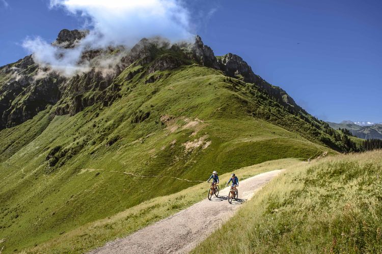
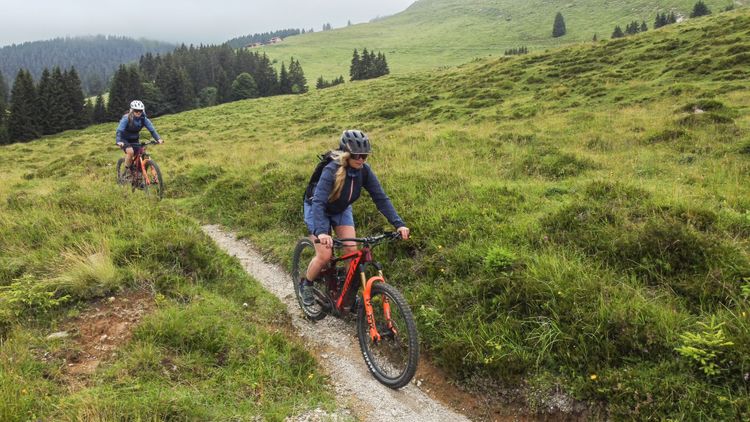
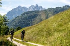
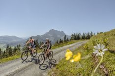
You will overcome fantastic passes with your bike, climb a lot of meters in altitude and even ride a lot of really great and challenging single trail passages. Be warned: There are also a few hike-a-bike sections to be overcome, but nothing wild. On the contrary, these passages will take you to some of the most beautiful and remote areas of the Kitzbühel Alps! A real "insider" tip.
You already guessed it: We definitely recommend a hardtail mountain bike or a very light race fully. With a Gravel bike you will have no joy on a few steep descents and especially on the single trails.
Particularly noteworthy is the infrastructure you will find along the way! Thanks to the tourist winter and summer infrastructure, as well as the well-developed public transport, you can easily arrange arrival and departure, find spare parts as well as food and accommodation. So if you're an experienced mountain biker looking for a real multi-day challenge, this is a great introduction to bikepacking for you! You can even book a ready-made package through Kitzbüheler Alpen Tourismus and have a hotel with half pension every evening and luggage transport on request. You can book the whole package here.
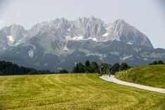
No matter how you conquer the Kitzbüheler Alpen Trail, 125 km and 4820m uphill will present you with a real challenge. Let's start with the daily stages. This is what awaits you on the Kitzbühel Alps Trail!
Stage 1 - From Hopfgarten im Brixental to Brixen im Thale
Getting there
In Hopfgarten we start our three day tour through the Kitzbühel Alps. Hopfgarten im Brixental has a train station where you can arrive by train from Innsbruck or Wörgl. Possible connections are S8, REX3 and REX2.
You want to start cycling in the Inntal? That is of course no problem. Take a look at the 1st stage of the KAT Bike E-njoy. It starts in Mariastein, but you could join the route in Wörgl and follow it from there to Hopfgarten.
Up to the Hohe Salve
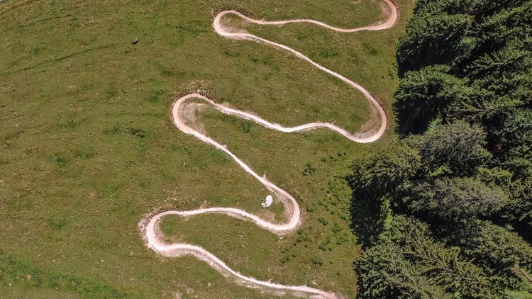
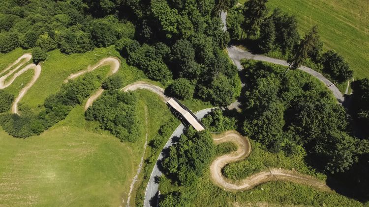
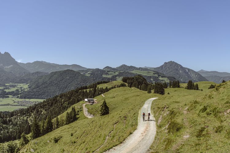
From there, follow MTB route 268 in the direction of Alpengasthof Rigi. The tour first leads very steeply in numerous narrow serpentines to the Schornhof. There, at the latest, it is worth taking a short break to enjoy the breathtaking view from one of the highest farms in the area.
Continue on gravel and soon after the farm through shady mountain forest. After a few more hairpin bends, you leave the forest line behind you and reach the beautifully situated alpine slopes at the foot of the summit of the Hohe Salve. You can already see the Rigi inn from afar. But just before you reach this waymarker, it is worth making a detour to the Kleine Salve with its romantic reservoir directly below the summit.
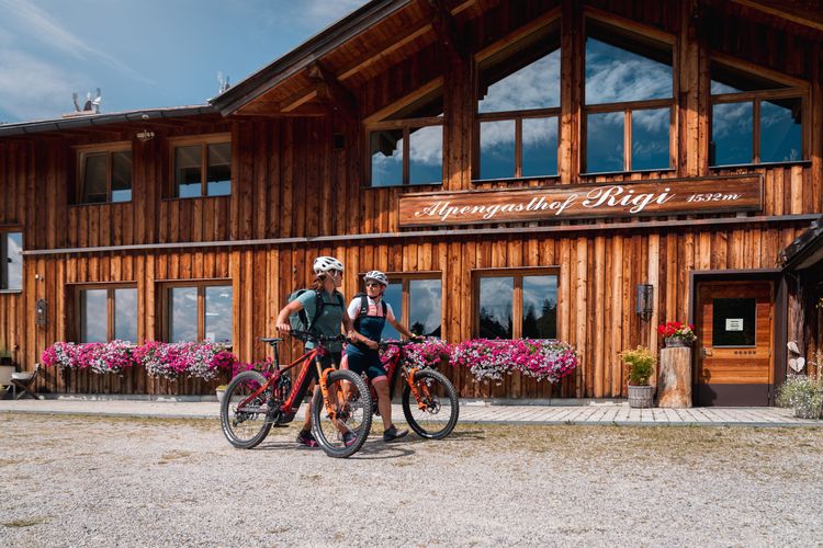
A break at the Alpengasthof Rigi
Finally, however, you really do get to the alpine inn. Here, at the latest, you have now earned a stop and a cooling drink. And the best thing about it: on the sun terrace you can enjoy it all with a wonderful view.
Descent to Westendorf
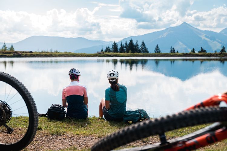
Once you have recovered your energy, you now follow MTB route 297. At first, this leads briefly uphill, but soon you reach the Salvensee, another highlight of the tour. From here, the descent is rapid in the direction of Westendorf. Passing the Hohe Salve reservoir, you finally reach the Brixental valley and the town of Westendorf again via many bends. There you change to the opposite side of the valley and follow the Brixental cycle path towards Brixen, where you have reached the tour destination.
Tip: Shortly before you reach your destination in Brixen, you pass the Brixner Baggersee, a quary pond - a wonderful opportunity to cool off after the strenuous tour.
Stage 2 - From Brixen im Thale to Oberndorf in Tirol
High up with variants
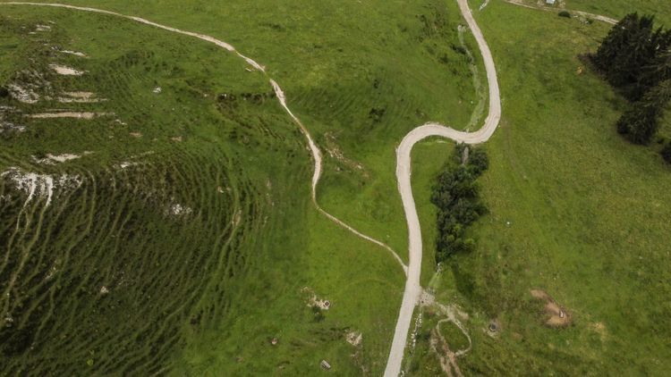
The second stage of our bikepacking trip through the Kitzbühel Alps takes us from Brixen im Thale to Oberndorf in Tyrol. With the Wiegalm Trail and the Fleckalm Trail (or whatever option you choose here), 2 real challenging trails are waiting for you! You don't dare to ride the single trails? You can follow the forest road.
Up to the Wiegalm
We start quite directly and without detours uphill along the Brixenbach. A beautiful forest road with a gentle incline at first, before the steep road with many serpentines up to the Wiegalm. After about 700 meters of ascent we arrive at the top of the Wiegalm. In bad weather, however, the Alm is closed.
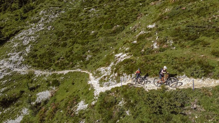
The Wiegalmtrail is marked in red. The markings are like in skiing: Blue is easy, red for advanced and black for very experienced mountain bikers. That means you should definitely have solid mountain biking experience here. Parts of the trail are steep and narrow with technically challenging turns. An incredibly beautiful flow trail in the middle is probably the highlight of the Wiegalm Trail! Further down in the forest it becomes steeper again and you have to lift your bike over a cattle fence. Below we come back to the forest road and finally we come out down in the valley near Aschau.
You prefer to stay on the forest road? Instead of turning right at the top to the Wiegalmtrail you can follow the forest road in the direction of Aschau. At the bottom you will reunite with the Wiegalm Trail.
At the bottom of the valley, the original route turns right (direction south) to Aschau. From there we follow the Aschau bike path deep into the valley towards the impressive Rettenstein. Before that we turn left at the Ragstattalm and follow the forest road upwards to reach the Aschauer Höhenweg.
ATTENTION
At the time we documented this route for you, the Aschauer Höhenweg was unfortunately closed and will probably not be finished before 2023.
There is an alternative: Once down in the valley, the original route turns right (compass direction south) to Aschau, while we turn left, to the north. We follow the road to Rettenbach until we reach the bridge over the Rettenbach. Directly before the bridge we turn right onto the Issbühelweg and follow it uphill. Shortly after Issbühel we turn left and leave the asphalt. We follow the path towards Hiesleggalm and soon we are at Usterkaralm on the original route.
So many trails. The dilemma of choice.
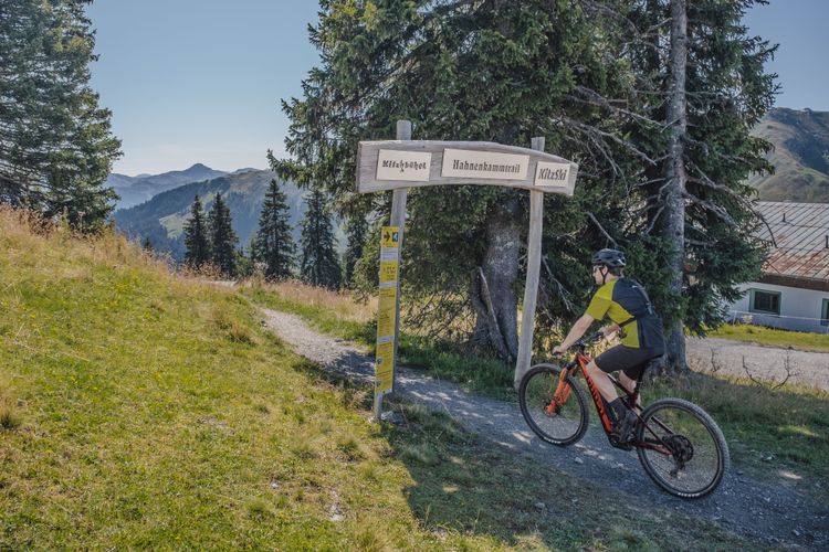
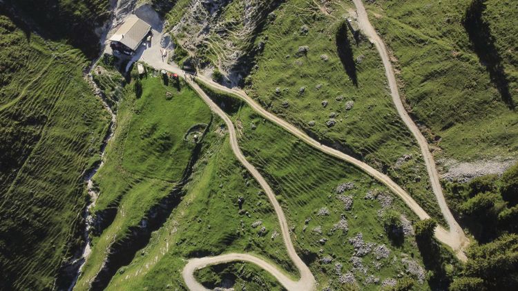
Now we are already at the top of Pengelstein!
In fact, now you are spoiled for choice: You are very experienced mountain bikers with full suspension mountain bikes and protective clothing? Then the Fleckalmtrail will give you the ultimate adrenaline kick. This is a black trail, so you should be sure of what you're doing here 😉.
Directly across from the Fleckalm lift is the blue Hahnenkammtrail. A really nice flow trail that will challenge you and shake you up, but without technical challenges like jumps or extreme root trails. You would rather do without single trails and ride downhill on a forest road? Instead of going up to the Fleckalmbahn to get to the trails, you can follow the forest road towards Kitzbühel.
Via Schwarzensee to Oberndorf
Now we simply follow the bike path and arrive in Oberndorf without any stress or traffic via the Schwarzensee lake. Another stage done! Have a good rest.
Stage 3 - from Oberndorf in Tirol to Fieberbrunn
Up to the Harschbichl
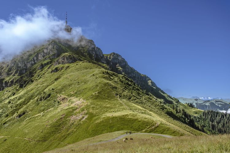
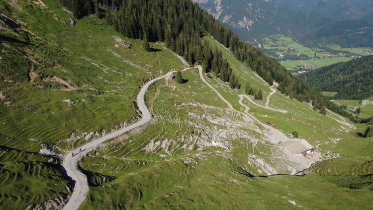
Without major detours we head from Oberndorf in a southerly direction and then with an arc in an easterly direction up towards the legendary Kitzbüheler Horn. Steep and on many serpentines the road winds upwards. About 7km uphill, but we’re going up for a good reason!
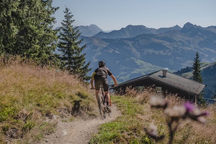
A beautiful forest road with smooth turns and a few serpentines brings us down to the middle station of the Harschbichlbahn. Here we ride along the reservoir and come to the beginning of the Harschbichl Trail.
Harschbichl Trail or forest road
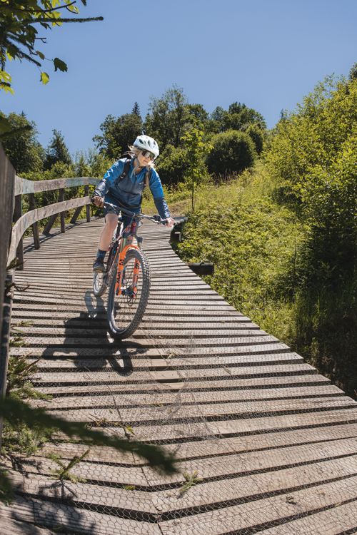
A red trail that invites with a beautiful gate made of wood for an extra portion of fun! 145 turns with north-shore elements and a few bridges, much in the forest but also with great views are ahead of us! A few roots, but also a few steep passages are in it, but an experienced mountain biker will get down here well and with a big grin!
You would rather skip the trail? To the right you can instead descend via the forest road.
At the bottom we arrive in St. Johan in Tirol.
Over St. Johann to the Kalksteinalmen
We follow the cycle path out of St. Johann in Tirol in a northerly direction. Shortly before Kirchdorf in Tirol we turn east. A steep asphalt road winds out of the valley and we quickly gain altitude. Soon we turn left. Behind a farm the asphalt ends and we continue on gravel. We have to overcome a gate with a bike ramp and then we continue uphill with many turns through the forest. We keep going, past the junction where the KAT Bike E-Njoy turns left to loop around the hike-a-bike.
Hike-A-Bike over to Winterstelleralm
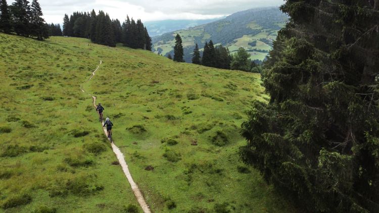
Soon we have reached the highest point and can briefly recover a bit on a piece of downhill. At a private alpine hut it is now time for the start of our Hike-A-Bike. An alpine meadow with a single trail in it gives us a gentle introduction to this challenging section. Soon it gets a bit rougher with stones and roots in the high forest, which make our way a bit more difficult. Now the first places where we have to carry the bike are coming. Surefootedness is definitely required here.
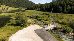
Now, in wide switchbacks, the road winds downhill, framed by a unique mountain panorama. We don't go downhill for long, then we arrive at the Winterstalleralm. The first serviced alpine hut since we left St. Johann.
Destination Fieberbrunn
We follow the forest road all the way down where we reach an asphalt road. To the right is a bike path. This leads to Fieberbrunn.
On a beautiful bike path we cycle ever so slightly downhill to Fieberbrunn. Many hotels and restaurants are waiting for you.
The memory of this tour will stay with you forever. A unique route in one of the hardest and at the same time most beautiful landscapes we can find in the world. The Alps! In our personal opinion this route is a real competition to a Transalp tour and harder but also more versatile than many Transalp tours variants.
You have questions or suggestions? Keep them coming! We are looking forward to your message.
Lies in
Lies in
Lies in
Lies in
Lies in
Lies in