When we designed the WOSSA Bikepacking Route we knew we had an exceptional chance. The chance to try and hands-on show the complex system of water circulation in the alps!
However, explaining such a complex topic to a wide audience is a tough goal, and frankly, we didn’t have the knowledge ourselves.
Luckily we were able to work with 3 scientists who gave us input and corrected our research so you can be sure you are actually learning something and hopefully you will have a fun experience seeing the topic outside while having an adventure on your bike!
We explicitly do NOT give an opinion but rather talk about certain phenomena and research. We leave it up to you to form your own opinion.
Take a deep dive into water circulation in the alps. This is going to be a long one, but we’re proud of it.
The Alps
The Alps stretch over 1200 kilometres from the French and Italian Mediterranean coast to the lowlands east of Vienna. They are densely populated and the weather and climate play an important role for millions of people, as the Alps influence fundamental economic sectors such as agriculture and tourism.
Austria and Bavaria both have a large share of the Alpine land mass. Infrastructure, climate, weather, economy and tradition are strongly characterised by the influence of life in the Alps.
High mountains and the water cycle
High mountains are special types of landscape that have a diverse significance far beyond their own borders. Climatically, high mountains are characterised not only by their particular altitude, which extends far into the upper troposphere, and the associated temperature levels, but also by their importance in global atmospheric circulation.
High mountain ranges largely prevent the exchange of air masses and thus ensure contrasting climatic conditions. For example, the Alps form a barrier between the warm and dry Mediterranean climate and the humid and temperate climate in Western and Central Europe and vice versa.
Water reservoir

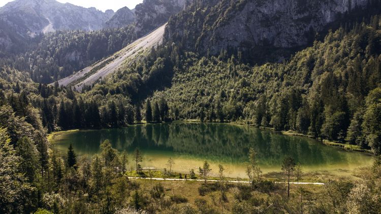
Secondly, mountain regions are able to store precipitation over longer periods of time and thus act as a water reservoir. This happens in three ways. Firstly, depending on the latitude and altitude, snowfall in many high mountain regions varies greatly from season to season. Snow stores water from the cold to the warmer months of the year and makes water available with a time delay when it melts, often when other sources dry up. Secondly, glaciers and permanently frozen ground (permafrost) form from layers of snow and low temperatures over longer periods of time. Like snow, these melt seasonally at higher temperatures and strong sunlight and serve as an important source of water in the dry season for areas downstream. Glaciers and permafrost bodies can be reliable water reservoirs for decades or centuries. And thirdly, mountain lakes in mountains are important water collectors, both tectonic and glacial, which are fed by runoff from direct precipitation as well as snow and glacier melt. Wherever humans have conquered the Alps as settlement areas, they have expanded this form of water storage by creating numerous artificial reservoirs.
In humid regions, 30-60% of fresh water comes from mountains, in desert-like and completely dry areas 70-95%. More than 250 million people worldwide live in the high mountain regions themselves. And more than 1.6 billion people live in regions that receive water from the high mountains, according to other sources even 3 billion people.
Water transport
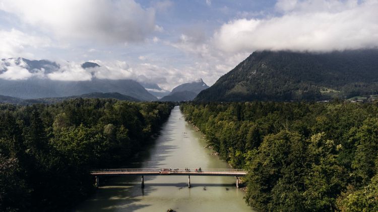
Due to their special climatic characteristics, high mountains provide important water resources for the mountain regions themselves and the surrounding foothills over great distances. Driven by gravity, the accumulating water is distributed to the surrounding area via widely branching river systems. On the one hand, there is more precipitation in high mountains than in lower regions. Moist air masses are forced to rise along mountain ranges. This cools them down, the water vapour they contain condenses and precipitation occurs in the form of rain or snow.
Rivers carry away water, sediment and organic material such as dead wood.
The potential energy of the water that rains down in the mountains is dissipated via rivers. The mobilisation and transport of sediment are important ‘regulatory functions’: if more water and more energy is available, the sediment is dissolved and carried along; if there is too little energy, it is deposited.
These transport functions and the energy balance also determine the shape of rivers, i.e. how they flow, meandering or branching, and whether there are gravel banks or steep banks. Interfering with the energy balance, e.g. by straightening rivers or using hydropower, inevitably changes the structure and character of the river - and thus also the biodiversity and ecological functions. It would often be possible to find an optimum - but to do so, our prioritisation of energy generation must change.
Utilisation of water

Humans utilise the water of the high mountains in many different ways. First and foremost, it is used for irrigation in agriculture. For example, 40% of the world's irrigation depends on rivers that originate in mountains. But just as important is the supply of drinking water in small towns and large metropolises, which are often connected to the water reservoirs of the high mountains by an elaborate water infrastructure. And in many cases, running water is used to operate hydroelectric power stations.
Climate change and the Alps
In many cases, climate change is threatening the water reservoirs in the high mountains in the long term. Since the end of the 19th century, average temperatures in high mountain regions such as Austria or Bavaria have been rising more than twice as fast as the global temperature of around 1°C, at more than 2°C. . One of the main reasons for this is the ‘inertia’ of the oceans, which dampens the global temperature increase. Regional warming rates are strongly dependent on the time of year. For example, the warming in the European Alps is most pronounced in summer and spring, whereas in the highlands of Tibet it is in winter. In general, the warming is stronger in higher regions than in the lower altitudes of the high mountains. The reasons for this are, for example, changes in the albedo effect. The lower the albedo, the more radiation from the atmosphere is absorbed by the landscape and converted into heat. In concrete terms, this means that a grey-brown mountain slope is heated significantly more than a white glacier surface. As a result, the decline in ice and snow cover intensifies the warming process and sets in motion a self-reinforcing downward spiral.
In the Alps, there has been no clear trend in the total amount of precipitation in recent decades. However, the seasonal distribution has. Due to the higher temperatures, there is an increase in liquid precipitation (the water vapour content of the atmosphere increases by 7 % with every degree Celsius), and numerous studies show changes in precipitation intensity and seasonal distribution. Projections for the 21st century show an increase in annual precipitation in the Alps of 5-20 %. The European Alps must expect an increase in extreme precipitation. In contrast, there will be decreases in the Mediterranean region.
In addition to snow thickness and distribution, the duration of snow cover in high mountains has generally decreased by 5 days per decade in recent decades. According to model projections, this trend will continue.
I would like to read more about it:
- Immerzeel, W.W., Lutz, A.F., Andrade, M. et al. (2020): Importance and vulnerability of the world’s water towers. Nature 577, 364–369,
- H. Grassl, et al. (Hrsg.). Warnsignal Klima: Hochgebirge im Wandel. pp. 23-27
Water Deep-Dive
As we covered the basics now, we want to explain certain important functions and topics to you based on POIs along our route.
This way you can see it with your own eyes, you can basically touch it and hopefully get to admire and see this unique piece of nature in a completely different way than before.
Across every region of the route we chose a few important points and topics that as a whole will describe water circulation in the alps for you. Follow along for a journey that will show you water in places where you didn’t even think of water.
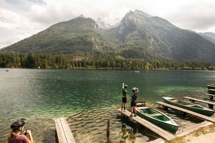
Blaueisgletscher - the northernmost glacier in the Alps and ‘its’ Hintersee
Water Reservoir

Challenge
How did the giant boulder with the tree on top end up in the lake? Or rather, how was the lake formed?
You can find the answer on the information boards around the lake.
Answer
The Hintersee was formed by a glacial rockfall!
The rocks and other material that blocked the outflow formed the lake.
We can now see the large boulders in the water as witnesses to this event.
Interesting facts about the Blaueisgletcher
- Northernmost glacier in the Alps
- Almost complete glacier retreat
- 1820 Glacier area 25 ha
- 2009 Glacier area approx. 7.5 ha
- Thickness in 2007 up to 13 metres
- Hintersee was formed by a glacial rockslide! (Signs at the Hintersee)
- Water reservoir
- → Water transport, Ramsauer Ache, Berchtesgadener Ache, Salzach
I would like to read more about it:
- https://www.nationalpark-berchtesgaden.bayern.de/service/publikationen/forschungsberichte/doc/fb_50.pdf
- https://www.berchtesgaden.de/blaueisgletscher.
- https://www.nationalpark-berchtesgaden.bayern.de/natur/wissenswertes/frueher_heute/index.htm
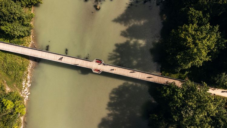
The Saalach a tamed river?
Water transport/ Utilisation and Conflicts

Challenge
Hydroelectric dams are one way of generating energy without fossil fuels. Estimation task: What percentage of electricity generation in Bavaria comes from hydropower? What percentage is it in Austria?
Answer
In 2022, 14% of electricity generation in Bavaria and 24% in Austria was generated by hydropower.
The difference in weighting is partly due to Austria's geographically favourable location in the Alps.
Hydropower is becoming increasingly important for us, but is not without potential problems.
Interesting facts about the Saalach power station
- The Saalach is one of the largest tributaries of the Salzach
- Human utilisation by power plants such as the Saalach power plant in Bad Reichenhall (Kirchberg)
- Built until 1914 to feed the railway network
- Reservoir above Bad Reichenhall
- Still in operation today
- Floods in 1920 and 1974 threatened the dam and led to its complete emptying in 1974
- As early as 1929, measures against silting up (sediments clog the dam, efficiency of power generation decreases).
I would like to read more about it:
- https://de.wikipedia.org/wiki/Saalachkraftwerk_Bad_Reichenhall
- https://www.stmwi.bayern.de/energie/erneuerbare-energien/wasserkraft/
- https://www.bmk.gv.at/dam/jcr:3820f7e7-4abb-4324-b8e0-aa090325eb4a/Energie_in_OE2022_UA.pdf
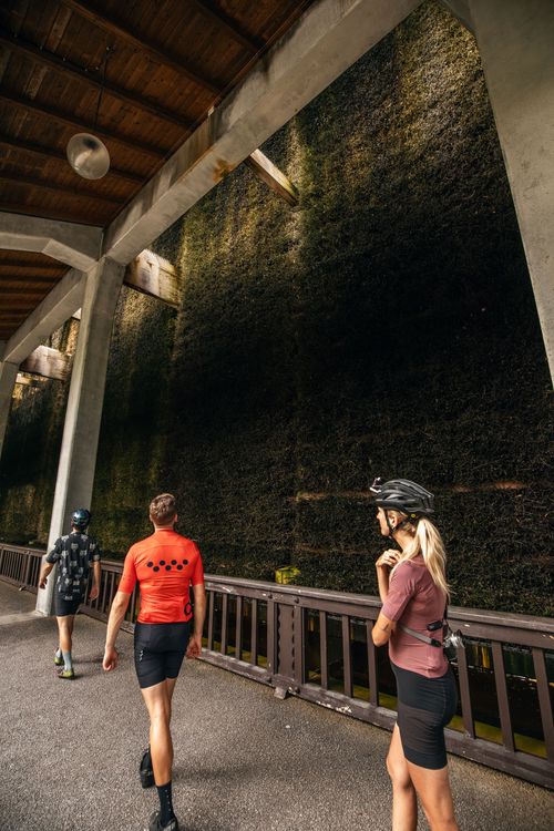
Gradierhaus - water as a health treatment!
Water utilisation

What is the Gradierhaus?
-
Built in 1912, 160 metres long and 13 metres high
-
High-percentage Alpine brine (26%) from the old salt works in Bad Reichenhall is mixed with water in the graduation house and evaporated via a wall of thorns, with the water level being checked regularly.
-
An automatic wind adjuster decides on which side the brine trickles over the blackthorn fields, depending on the wind direction.
-
The water is sprinkled from a height of 13 metres through channels with numerous holes, making the brine more concentrated and creating aerosols that are used for health-promoting inhalation.
-
The sprinkling area is around 2000 square metres per side, and the thorns used from Poland are ideal for the evaporation process due to their branching.
-
It is recommended that you walk slowly for half an hour a day on the side of the graduation house facing away from the wind and breathe deeply through your nose to benefit from the healing effects of the air.
-
I would like to read more about it
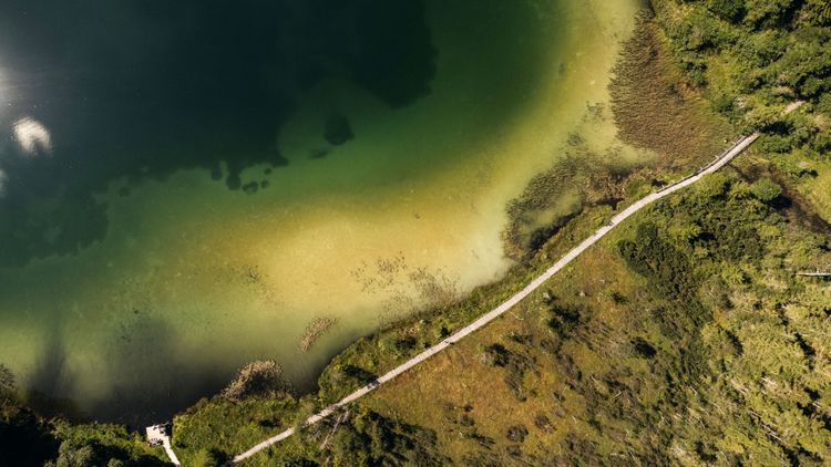
The Frillensee lake - a frosty microclimate
Water reservoir

Challenge
Frillensee is the coldest lake (body of water) in Central Europe. Why do you think that is?
Answer
Frillensee is a cold air lake. The cold air sinks downwards and gets ‘stuck’ in the basin. You can easily understand this: When you boil water, the hot water vapour rises. It's the same with warm air.
In addition, cold water from the surrounding mountains is constantly flowing into the lake, mixing the water and making the temperature cold.
Interesting facts about the Frillensee
- coldest body of water in Germany
- Funtensee is the place with the coldest air temperature ;)
- Why? Frillensee lies in a basin. Cold air masses sink downwards and accumulate at the low-lying Frillensee, as they are heavier than the warm air masses.
- This phenomenon is known as a ‘cold air lake’. In general, the microclimate here is influenced by the surrounding topography.
- In addition, cold water constantly flows through the surrounding karst rock into the Frillensee.
- In summer, the average water temperature is around 10°C
- → Coldest lake in Central Europe
I would like to read more about it:
- https://www.lss.ls.tum.de/fileadmin/w00bds/aquasys/upload/-Standort_Iffeldorf/Bayerische_Seen_im_Klimawandel_barrierefrei.pdf
- https://www.zamg.ac.at/cms/de/klima/news/temperaturinversionen-sind-seltener-und-schwaecher-geworden
- https://phaidra.univie.ac.at/detail/o:1345169
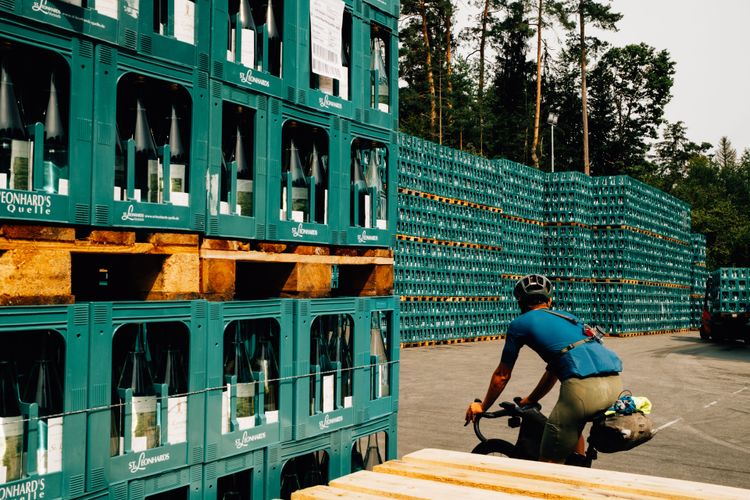
Spring water - an inexhaustible resource?
Water reservoirs - Utilisation/ Conflict

Challenge
What is artesian water?
Answer
Artesian water often accumulates for centuries between impermeable layers and then finds its way upwards due to the excess pressure.
Interesting facts about the springs along the route
- Springs are localised areas where groundwater emerges and then flows off above ground
- Groundwater access and natural, i.e. also man-made sources (groundwater wells) are important for the drinking water supply
- In Bavaria and Austria in particular, there are famous springs where companies sell this water across borders
- Along the route, for example:
- Adelholzener Quelle
- St Leonhardsquelle
- St Georg Quelle
- …
- Groundwater reservoirs have a limited volume and must be renewed through infiltration processes (groundwater recharge). Our consumption is high and in periods of drought without recharge, groundwater levels fall and only recover very slowly afterwards.
- Commercial use leads to additional conflicts and bottlenecks
- Climate change leads to longer dry spells
- → Groundwater is declining
- → Soil sealed due to drought
- → Soil can absorb less water
- Less and less groundwater is available while we extract more and more
- However, mineral water companies such as Adelholzener are now also taking a stance on the issue and using sustainability reports to show how they intend to deal with the problem.
I would like to read more about it:
- https://www.lfu.bayern.de/natur/quellen/index.htm
- https://www.abendzeitung-muenchen.de/bayern/kampf-ums-wasser-wenn-konzerne-in-bayern-quellen-kaufen-art-875956
- Adelholzener Mineralquellen Nachhaltigkeitsbericht 2022
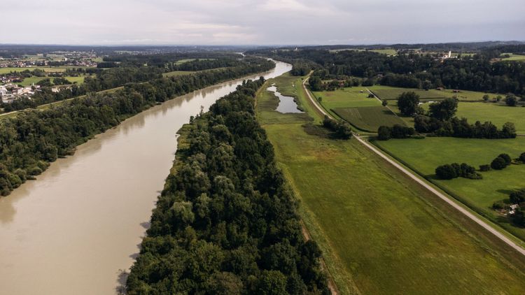
Flood protection along the Inn
Water transport/conflict


Challenge
Between the dam on which we are travelling and the Inn lies a large, empty green space. What is it there for?
Answer
You are standing next to a flood polder. In other words, an area that is ‘sacrificed’ in the event of a flood, giving the water volume more space and slowing the water down due to the mechanical friction of the surface over which it flows.
Hydrologist Ingo Schnauder on the problem and why there will always be floods
In Rosenheim, the small Mangfall flows into the larger Inn, which is why it continues from there as the Inn.
As the Mangfall near Rosenheim only has an average discharge of 18 m³/s, it is of no interest for large-scale hydropower generation. The situation is quite different with the Inn at 300 m³/s. Over a river length of 180 km, 19 dams were built, i.e. one about every 10 km.
As a result of the power station constructions, the Bavarian Inn today has a largely lowland river character with wide, open expanses of water. A total of 19 hydroelectric power stations were built there from 1924 onwards. The interruption of the free-flowing river by diversions and weirs, as well as the hydropeaking caused by the power plants, have led to significant ecological impairments. For this reason, the structure and flow conditions of the Inn in this area have been massively altered. Due to wastewater discharges in the 1950s, the Inn was also heavily polluted in places along this stretch. The river only reached quality class 2 again in the entire Bavarian region in 1995 (innsieme.org).
In the reservoir area, the river loses its actual character and becomes more of a lake. The typical river species hardly find any living conditions there, except for the generalists, which manage reasonably well everywhere and are therefore not endangered. Every river has a bank, and therefore also slow-flowing areas. However, if these generalists were exposed to the full current, they would have no chance and the river would remain largely devoid of life. Such conditions require specialists from an available spectrum of species - biodiversity!
How high the price we really have to pay for hydropower is is difficult to estimate in monetary terms. Although there is the concept of ‘ecosystem services’, it is not trivial to prove, for example, how an improved local recreational value is reflected economically in the reduction in cases of disease. It is even more difficult when it comes to biological aspects such as biodiversity, which we as humans usually perceive less directly. One of the few exceptions here is certainly sport fishing, and the tourist income from it, which correlates directly with the occurrence of certain fish species.
However, the expansion of the power plant has had an impact on the fish fauna on the Lower Inn, as reservoir areas with a silted substrate are no longer suitable for typical gravel spawners. In addition to the formerly typical species such as barbel, nase and huchen, which are now only found sporadically, fish species that prefer calmer river sections or stagnant waters have now colonised the river - including bream, carp, pike, rudd and roach. (innsieme.org)
Floods have always been and always will be. Why are we always frightened anew and why is there no worthy solution?
Firstly, it is difficult because almost all the boundary conditions that contribute to flooding and flood risk are constantly changing. In addition, the interdependencies in the river system are often not immediate and direct. It takes time for a change to become apparent. The same applies to climate and climate change, where it certainly takes even longer.
Flood protection and flood management have been around for as long as humans have been settling. We learnt from experience - and our ancestors probably chose the new cave after the flood so that it was much higher. We know the danger.
However, the flood protection programmes of the last 100 years have also made us somewhat naive. Protection against a 100-year flood, for example, is still abstract. On the one hand, because it is a statistical value and a 100-year flood does not of course mean ‘once in 100 years and then it's calm’. Secondly, because it makes us feel safe from flooding. But a flood that is somewhat larger, e.g. statistically a 110-year flood, will of course hit us hard. These are also two reasons why the last major floods also led to major disasters.
A comment on statistics. Statistics is the evaluation of measured time series and the assignment of corresponding frequency distributions - strictly speaking, a modelling approach. Consistent data for this is usually only available for the last 100 years for most rivers, if at all. So where does the value for the 100- or 1000-year flood come from? And if we ever had a 1000-year flood, would we even be able to measure it and know that it was one?
The consequences of the technical expansion of rivers, straightening, course shortening and canalisation are typical and omnipresent regulation measures that have historically been carried out for various reasons - but of course also for flood protection. Quickly draining and getting rid of the water seemed to be the best strategy at first. And this works best in a straight channel with concrete walls or even in a concrete pipe, in the case of smaller streams in urban areas - the so-called ‘culverting’ of the stream. However, the fact that this only shifted the problem ‘downstream’ and drastically reduced the warning times for downstream residents only really became clear when this strategy was applied across the board. Earlier retention areas, which stored water and thus attenuated floods, lost this important function due to urbanisation. Seeing water not as a problem but as a precious commodity, not as a ‘friendly service to the next town downstream’ but as a reserve for dry times, became more than clear during the droughts of recent years.
Reclaiming and or creating new retention areas for rivers is therefore a high priority. Possibilities include, for example:
- Reconnect alluvial forests and make them flowable againReconnect alluvial forests and make them passable for flow
- Create flood polders, some of which can also be operated in a controlled manner in order to specifically cut flood peaks
- Rainwater retention basin in the drainage area
Are you standing in a flood polder or flood zone?
Check out the map!
I would like to read more about it:
- https://www.innsieme.org/drei-laender-fluss/der-inn-in-deutschland/
- https://geoportal.bayern.de/bayernatlas/?lang=de&topic=nage&bgLayer=atkis&catalogNodes=1
- https://www.gkd.bayern.de/de/fluesse/abfluss/bayern/rosenheim-18209000/statistik
- https://www.gkd.bayern.de/de/fluesse/abfluss/bayern/rosenheim-o-d-mangfallmuendung-18001508/statistik
- https://books.google.de/books/about/Strömungsstruktur_und_Impulsaustausch_i.html?id=6S69nQEACAAJ&hl=en&output=html_text&redir_esc=y
- https://www.wwa-ro.bayern.de/projekte/hws_mangfalltal/index.htm
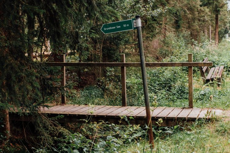
Bogs: Mosses and felts - Same, same, but different
Water Reservoir

Challenge
What is the difference between moss and felt?
Answer
A moss is a low moor or fen, a felt is a raised bog.
Interesting facts about mosses and felts and why they are becoming increasingly valuable to us
- Bogs and fens are permanent wetland areas in which water flows in permanently, but only little water flows out
- Felt: A raised bog, the water penetrates through precipitation and cannot drain off.
- Moss: Moos (Moss), as fens are called in Bavaria, is flat and lies below the groundwater table. Groundwater constantly flows in and brings new nutrients with it, which is why fens are richer in nutrients than raised bogs. More diverse plant species and trees grow in the moss.
- In the past, we drained many moors, especially for agriculture, and now they are often rewetted.
- Peatlands store about twice as much CO2 as forests. However, 90% of the peatlands in Germany have been drained.
- As water reservoirs and ecosystems, they are also an important regulator for the landscape and can therefore have a decisive impact on biodiversity.
I would like to read more about it:
- https://www.boell.de/sites/default/files/2023-02/mooratlas2023_web_20230213.pdf
- https://www.br.de/nachrichten/wissen/welttag-der-feuchtgebiete-warum-intakte-moore-das-klima-kuehlen,U2pmmhG
Hornspitz ski area at the Dachstein - soon no more snow?
Water utilisation / conflicts

Winter tourism is increasingly being criticised. In some places (including the Dachstein glacier ski area), operations have had to be cancelled.
This poses many challenges for the businesses, but they are not completely hopeless.
What can ski resorts do about the lack of snow?
- The ski area is part of the Dachstein West ski region, offers pistes for beginners to advanced skiers and is particularly popular with families. There are modern lifts, ski schools and a good infrastructure for winter sports enthusiasts.
Challenges posed by climate change
- Lack of snow: Rising temperatures reduce snow reliability, especially at lower altitudes such as the Hornspitz, which can affect skiing operations.
- Shortened ski season: The duration of the ski season is getting shorter, as snow often falls later in winter and melts earlier.
- Costs for artificial snowmaking: Snow cannons are increasingly being used to ensure operations, which entails high costs and additional water consumption.
- Environmental impact: The use of snow cannons and the adaptation of the piste landscape have an ecological impact, such as increased energy consumption and interference with nature.
Adaptation strategies:
- Investments in snowmaking systems: The ski resort must increasingly invest in modern and more efficient snowmaking technology to compensate for the lack of snow.
- Year-round tourism: Many ski resorts, including the Hornspitz, are now also promoting summer activities such as hiking and mountain biking to cushion the decline in winter sports tourists.
- Altitude and snow reliability: Ski resorts rely on co-operations with higher-lying areas in order to be able to offer attractive alternatives in winters with less snow.
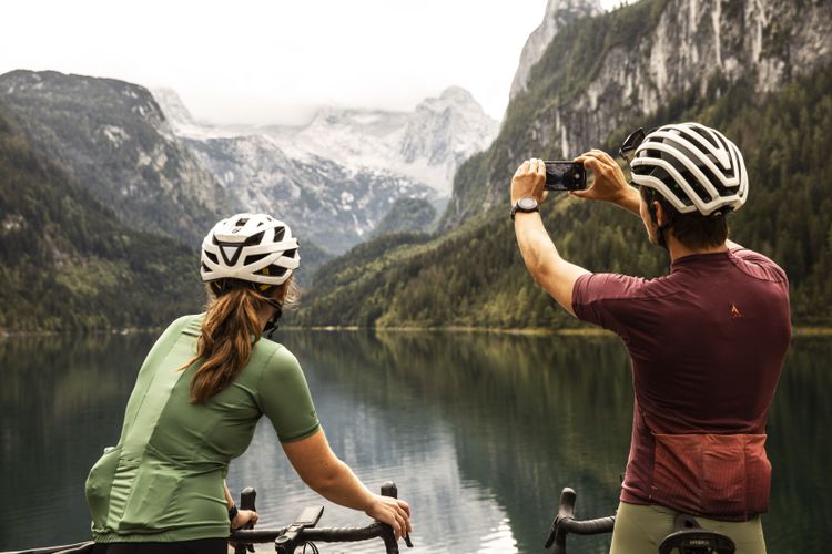
The Dachstein glaciers - stumbling giants
Water Reservoir

Challenge
Place a dark object and a light-coloured object in the sun for 10-20 minutes and compare the temperature. What differences can you see and what is this effect called?
Answer
This is known as the albedo effect. Light-coloured surfaces reflect a much larger proportion of the radiation that reaches them.
Dark surfaces absorb significantly more radiation and heat up as a result. As a result, a shrinking glacier does not reduce its thickness linearly, but exponentially.
As large water reservoirs, the shrinking of glaciers has major consequences for us, especially in dry months!
More information about the Dachstein glacier
- The Dachstein mountains are home to the easternmost and largest glacier group in the Northern Limestone Alps.
- Due to its north-facing orientation and favourable shielding from sunlight by rock formations, as well as the precipitation-rich area north of the main Alpine ridge, it is shrinking more slowly than other glaciers.
- In 2017, the glaciers spanned over 3km²
- Between 1947 and 2022, the ice thickness on 2600m decreased by 55m. That's about 18 storeys in a house.
I would like to read more about it:
- https://dachsteingletscher.info/das-projekt/forschung/
- https://dachsteingletscher.info/das-projekt/dachsteingletscher/
- https://www.anisa.at/Gletscherzustandsbericht_Dachsteingebirge_2022.html
- https://www.nachrichten.at/oberoesterreich/endstation-fuer-den-skilauf-lifte-auf-dem-dachsteingletscher-werden-abgebaut;art4,3802876
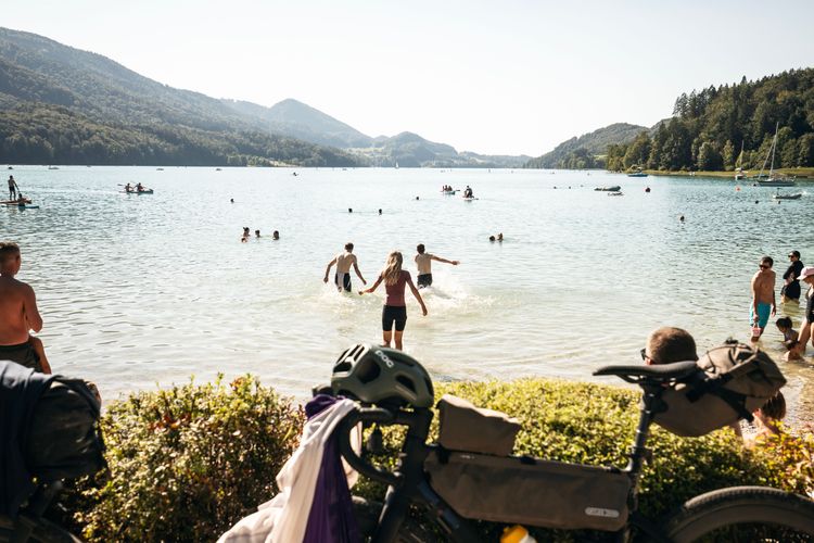
Fishing and the azure blue lake - a tradition!
Water Utilisation/ Potential Conflicts

Challenge
Why does more algae in a body of water mean fewer fish?
Answer
The algae themselves consume a lot of oxygen, which means less oxygen for other creatures such as fish. The proliferation of algae also changes the light conditions. In addition, more algae means less zooplankton for small fish, whose reduced population affects the large predatory fish. In general, this means a change in the food chain.
This is just one example of how comprehensively small changes can affect our environment.
Interesting facts about Lake Fuschl
- Lake Fuschl is one of the cleanest lakes in the Salzkammergut
- Its azure blue water is its great feature
- Fishing is one of the great traditions at the lake (char, trout,...)
- Motorised boats are prohibited on the lake, the municipality and organisations concerned are strongly committed to maintaining the water quality
Climate change scenario
- Rising water temperature
- Algae multiply, oxygen content and clarity of the lake decrease
- Water levels become more unpredictable due to storms, melting snow (or the lack of precipitation)
- Fish that need cool and oxygen-rich water (e.g. lake trout) are dying out
- Fishing COULD die, tourism would suffer
- Fortunately, we are a long way from this at the lakes in the Salzkammergut!
I would like to read more about it:
- https://fuschlsee.salzkammergut.at/salzburg-see-orte/die-region/artikel/detail/4447/fakten-ueber-den-fuschlsee.html
- IPCC. (2022). Climate Change 2022: Impacts, Adaptation and Vulnerability. Contribution of Working Group II to the Sixth Assessment Report of the Intergovernmental Panel on Climate Change
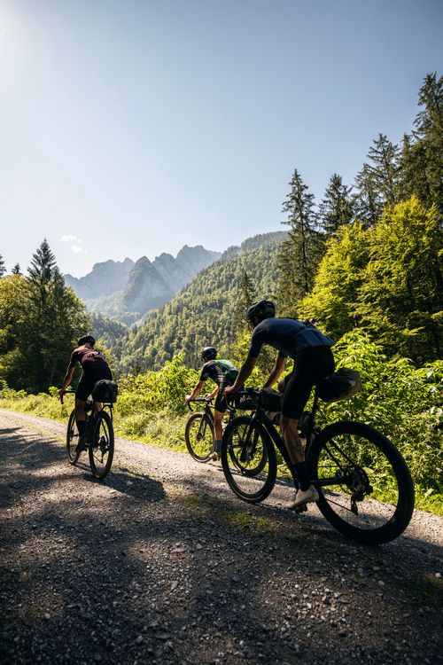
The Tennengebirge mountains as a water and climate divide
Water Reservoir / Water Transport


Challenge
The Tennengebirge is a karst system. What does this mean for the function of the Tennengebirge in relation to water?
Answer
The karst rock is an important water filter and water reservoir.
If you look at the shape of the mountains and think about how the water flows from top to bottom, you can visualise it here.
Why are the Tennengebirge mountains important for Salzburg's climate?
- Tennengebirge is located in the northern Limestone Alps in the Austrian province of Salzburg, between the Salzach and Lammer rivers
- Highest peak: At 2,430 metres, the Raucheck is the highest mountain in the Tennengebirge
- The mountains consist mainly of limestone and dolomite, which create typical karst formations such as caves and sinkholes
- Karst landscape: Thanks to its karst formation, the mountains store large quantities of water, which is collected in underground cave systems
- The Eisriesenwelt, one of the largest ice caves in the world, is located in the Tennengebirge mountains near Werfen
- Thanks to its high water storage capacity, the Tennengebirge plays an important role in supplying water to the surrounding regions
- As a mountain range, the Tennengebirge regulates the local climate by influencing precipitation and maintaining cooler temperatures at higher altitudes
Functions
Water Reservoir:
- Snow
- Underground reservoirs in the karst
Water Transport:
- Source of many mountain streams
- Mouths into the larger rivers
In months with little precipitation, reservoirs such as the Tennengebirge provide us with a crucial water supply through snowmelt
Climate Regulation
- Cool air masses and humidity: Due to the altitude of the Tennengebirge, the mountains act as a natural barrier for air currents. Moist air masses from the north or west accumulate on the mountains, cool down and lead to precipitation, which is crucial for the climate and water supply of the surrounding valleys.
- Regulation of temperatures: The mountains influence the local climate by maintaining cooler temperatures at higher altitudes. This cooler mountain air can have a positive effect on the surrounding area, especially during heatwaves.
- Wind barrier: The Tennengebirge can act as a barrier to wind currents, which influences the distribution of precipitation and wind conditions in the region. It creates microclimatic differences between the windward and leeward sides of the mountain range (windward and leeward sides).
Climate change and its consequences for the Tennengebirge
- Decrease in the amount of snow and snowmelt
- → Less water in valleys due to melting
- → Earlier melting and strongly fluctuating weather events lead to temporary water floods
- Change in the precipitation pattern:
- Increase in extreme weather events: Climate change is leading to heavier and more irregular rainfall. The Tennengebirge could be affected more frequently by extreme rainfall, which increases the risk of flooding and landslides. These events jeopardise the stability of the slopes and the safety of the surrounding settlements.
- Dry periods in summer: Longer and more frequent dry periods in summer could lead to water shortages in the surrounding regions, as less water flows from the mountains into the rivers. This affects both agricultural irrigation and the drinking water supply.
- Risk of erosion and natural hazards:
- Increased erosion and mudslides: The soil in the mountains is becoming increasingly unstable due to the decline in snow and ice cover. This increases the risk of erosion, mudslides and rockfalls. Such natural hazards not only jeopardise the surrounding settlements, but also the tourist infrastructure and can impair the flow of water into the surrounding rivers.
- Flood protection at risk: If the natural vegetation and snow as a protective layer decrease in winter, water can run off uncontrollably and lead to flooding. At the same time, the risk of avalanches increases in snowy winters.
- Water supply in danger:
- Falling groundwater levels: Less snowfall and changing precipitation patterns could cause groundwater levels in the region to fall in the long term. The Tennengebirge, which plays an important role in groundwater formation due to its porous limestone formations, could lose this function. This would have a significant impact on the water supply in the surrounding valleys and communities.
- Competition for water resources: In times of water scarcity, competition for water increases between agriculture, tourism, industry and households. Increasing water consumption by tourists (e.g. in ski resorts) could place additional pressure on the water supply.
I would like to read more about it:
- https://service.salzburg.gv.at/ins/external/displayRegion?id=498
- https://www.icpdr.org/sites/default/files/05_KAJFEZ_Climate_Change_Alps.pdf
- https://www.zobodat.at/pdf/Hoehle_057_0003-0016.pdf
- IPCC. (2022). Climate Change 2022: Impacts, Adaptation and Vulnerability. Contribution of Working Group II to the Sixth Assessment Report of the Intergovernmental Panel on Climate Change
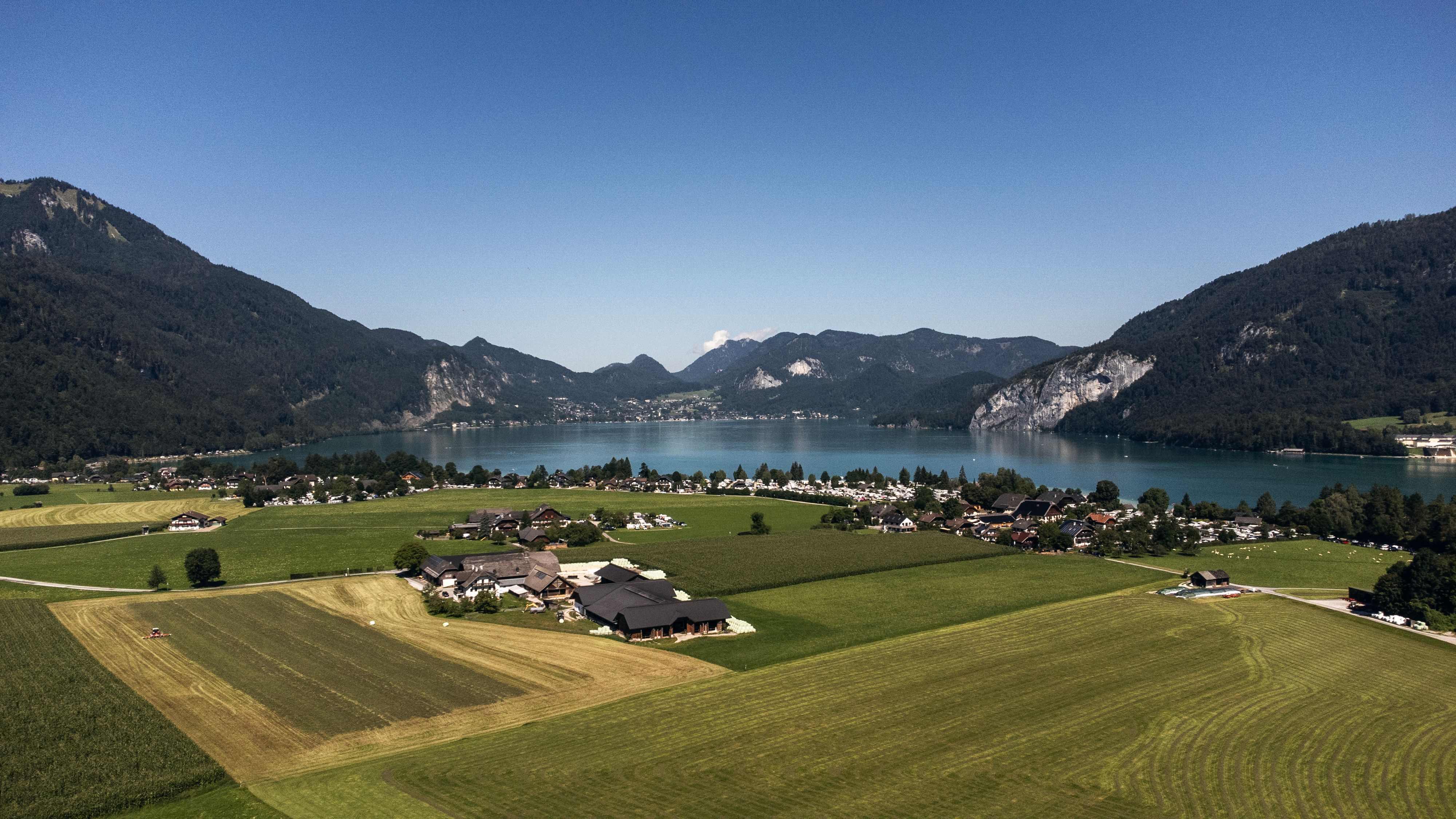
Lake Wolfgang - a glacial lake?
Water Reservoir

Challenge
How was Lake Wolfgang formed?
Answer
Lake Wolfgangsee is a glacial lake!
How could Lake Wolfgang have been formed by a glacier?
- The area around Lake Wolfgangsee was always glaciated during the ice ages.
- The mighty Traun Glacier branched off at Bad Ischl and flowed with a side branch through the Ischl Valley across Lake Wolfgangsee to Lake Mondsee.
- At the peak of each glaciation, large ice masses filled the valleys and repeatedly reached up to around 1400 metres above sea level. Only the summit area of the Schafberg protruded from the ice flows as a nunatakker. In the valleys, deepened basins were formed, which are now filled with lakes and their deposits.
Read more
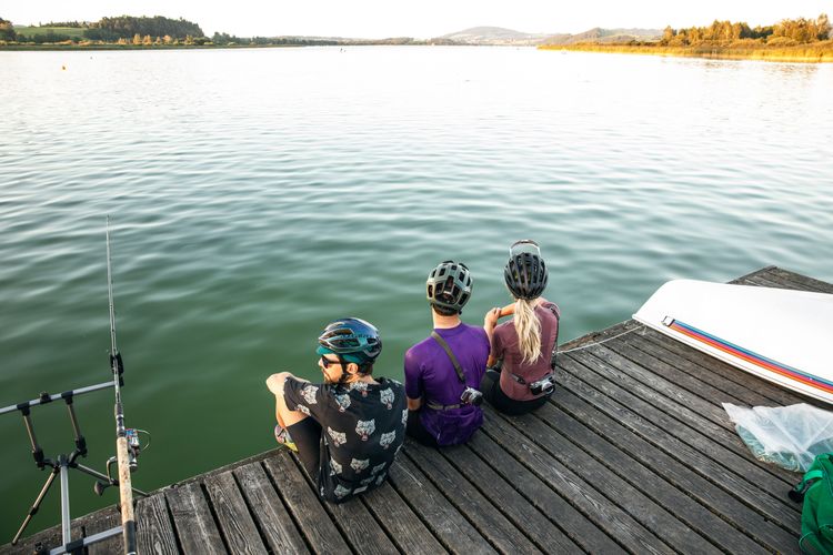
Drinking water quality in the Salzburg Lake District
Water Reservoir / Utilisation and Conflict


Challenge
Why do most mountain lakes have drinking water quality?
Answer
Salzburg's lakes are famous for their drinking water quality.
Almost all of Salzburg's lakes are mountain lakes. They are particularly clean due to a lack of nutrients (oligotrophy) and natural filtration.
But what does clean actually mean?
What does drinking water quality mean? Should all lakes be of drinking water quality?
In Austria, the drinking water quality of a body of water is strictly regulated and monitored. For a lake, this means that the water must fulfil the requirements of the EU Drinking Water Directive and the Austrian Water Act. These criteria include physico-chemical, microbiological and organoleptic aspects.
Criteria for drinking water quality
Microbiological quality:
- No pathogenic bacteria, viruses or parasites.
- Limit values for Escherichia coli and enterococci: <1 colony-forming unit (CFU)/100 ml.
Chemical quality:
- Low levels of nitrate, nitrite, phosphate and heavy metals.
- No pesticides or their residues above the specified limits.
Organoleptic properties:
- No noticeable taste, odour or unusual turbidity.
- Transparency and natural colour tone.
Physical parameters:
- Oxygen content and temperature must be in a natural balance.
- pH value: 6.5 to 9.5.
Are lakes with drinking water quality good for an ecosystem?
Benefits for people and nature:
- Lakes with drinking water quality can not only contribute directly to the drinking water supply, but are also an indicator of an intact ecosystem.
- They are particularly sensitive to soiling and often require long-term protection.
Disadvantages or restrictions:
- Lakes that are trimmed to drinking water quality often have less biodiversity as they lack certain nutrients that are important for plants and animals.
- A nutrient-poor body of water (oligotrophic) often has less productive fish stocks or other aquatic organisms.
Can lakes without drinking water quality be ecologically valuable?
Yes, lakes without drinking water quality are by no means inferior and are often essential for biodiversity:
- nutrient-rich lakes (eutrophic):
- They provide habitats for a variety of plants, animals and microorganisms.
- These lakes are often species-rich and irreplaceable for many animals, such as birds or amphibians.
- natural processes:
- Lakes with higher nutrient levels often support productive fish populations.
- They can fulfil important functions such as filtering pollutants and regulating water flows.
More on the topic
Thanks to the supporting scientists
Finally, we would like to thank the scientists who have supported us with their input and knowledge during this project.
Ingo Schnauder
Dr.-Ing., Techn. Leiter Versuchsanstalt für Wasserbau
Universität Stuttgart

Dr. Markus Keuschnig, MSc.
Co-Founder, Managing Director
GEORESEARCH Forschungsgesellschaft mbH
Nils Rüther
Prof. Dr., Professur für Wasserbau und Wasserwirtschaft
TU München
Thank you to all our tourism partners
